News ◦ 21—09—2017
SHARE

Supporting the Common Agricultural Policy through Earth Observation-based services

News ◦ 21—09—2017

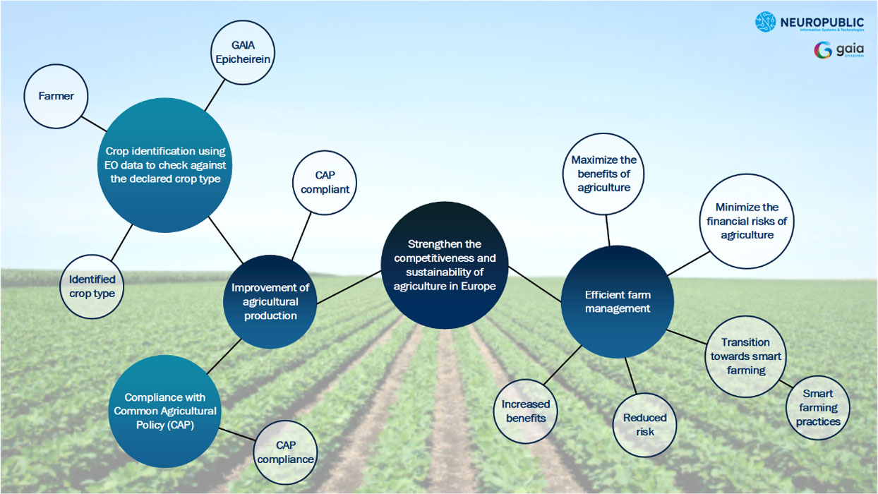
NEUROPUBLIC and GAIA EPICHEIREIN have launched an ambitious pilot in Northern Greece, under the umbrella of the H2020 Big Data Lighthouse project “DataBio”.The pilot intends to validate EO-based services that aim to meet the needs of the CAP value chain stakeholders.

CAP effectiveness

CAP effectiveness is crucial for 22 million farmers and agricultural workers in EU. Yet, it is limited by administrative burdens, high complexity and implementation costs. The reduction of delivery costs is a key priority for the whole EU and not only its National Payment Agencies. EU is looking for good practices that will not affect the effectiveness of the CAP.

Earth Observation (EO)

Earth Observation (EO) is proposed as the best tool for efficient implementation of the CAP. Till now, EO has only been used by to perform “Controls with Remote Sensing” (CwRS) for the purposes of the annual verification of subsidies claims.
The EC and the JRC stressed together the need for EO-based agricultural monitoring that will not only be used for the assessment checks, but will also support the total CAP implementation and its instruments such as the Good Agricultural and Environmental Monitoring (GAECs) and the Farm Advisory System (FAS).
Recent technological improvements regarding big data handling, available computing power and Copernicus Sentinel data and imagery allow for the continuous and automated provision of agri-environmental information for monitored objects such as agricultural parcels.

Precision and/or Smart Farming

Precision and/or Smart Farming is a sector that relies on many of its key business process on the EO technology. In the upcoming CAP, the Precision and Smart Farming and EO are valuable tools, because their combined use leads to an optimal and sustainable production and allows the provision of advisory services based on facts.
NEUROPUBLIC and GAIA EPICHEIREIN have launched an ambitious pilot in Northern Greece, under the umbrella of the H2020 Big Data Lighthouse project “DataBio”. The pilot intends to test the EO-based services, so to cover the needs of the CAP value chain. The pilot intends to validate EO-based services that aim to meet the needs of the CAP value chain stakeholders.The pilot activities will focus on annual crops with an important footprint in the Greek agricultural sector (e.g. dry beans, cotton, wheat, rice). The services to be tested will rely on innovative tools and complementary technologies and support the simplification and improving the effectiveness of CAP. They will sustain:

  • the interconnection with IoT infrastructures and EO platforms
  • the collection and ingestion of spatiotemporal data
  • the multidimensional deep data exploration and
  • the modeling and the provision of meaningful insights

GAIAtrons & data collection

To support the above-mentioned remove activities, NEUROPUBLIC already collects and stores field-sensing data through its network of telemetric IoT stations, called GAIAtrons. GAIAtrons offer configurable data collection and transmission rates.

Until now, over 1M samples have been collected and stored in NEUROPUBLIC’s private cloud infrastructure. These samples refer to atmospheric and soil measurements from various agricultural areas of Greece. Gaiatron stations measure among others:

  • soil temperature
  • humidity (multi-depth)
  • ambient temperature
  • relative humidity
  • barometric pressure
  • solar radiation
  • leaf wetness
  • rainfall volume
  • wind speed and direction

Remote sensing data from the new Sentinel-2 optical products (13 spectral bands) are also extracted and stored within the same cloud infrastructure. These data comprise both raw and processed (corrected products, vegetation indices) and are represented in raster formats. They are being handled using optimal big data management methodologies.

The pilot activities

In the context of the pilot activities, NEUROPUBLIC has also developed a set of web services to help data sharing and file distribution. Moreover, it exploited optical Sentinel-2 data for the multitemporal extraction of vegetation indices at the parcel level. An object-based methodology (where each agricultural parcel is considered an object) allows the creation of data-driven crop type models following machine learning methods. The established crop type models are used for the classification of the incoming time series data for a given polygon (crop estimation) which further extends the functionality of the system by providing means for the analysis of crop growth patterns. The convergence of high computing power, machine learning, IoT based data streams, geospatial data analysis and satellite imagery is “a perfect storm that’s just beginning to peak” and as such the ambition of the current pilot is to exploit the “produced power” for dealing effectively with CAP demands for agricultural crop type identification, parcel monitoring, collaboration, transparency and analytics.

The benefits

Value chain stakeholders (GAIA EPICHEIREIN, farmers, farming cooperations, OPEKEPE etc.) will benefit from the EO-based products and services in the key business process, including:

  • The farmer decision-making actions during the submission of aid application
  • The Farmer transition towards Smart Farming
  • The Paying Agencies actions that are related to the automated remote sensing controls
  • The performing of analytical governance

Read more information here.