Remote Sensing Services – Earth Insight

NEUROPUBLIC, by processing huge volumes of Earth Observation data, provides geo-analytics as a service to deliver decision support to its customers. Our Earth Observation applications serve all stakeholders in the agrifood and rural sector with significant information for optimizing agribusiness across Europe.

In short

NEUROPUBLIC develops and uses cutting-edge tools to solve technological challenges in monitoring Earth’s surface by handling large volumes of Earth Observation data. Focusing on high quality and state-of-the-art technologies, NP’s remote sensing experts provide first-class geospatial solutions to real world problems. We serve the agricultural sector via tailor-made monitoring system applications empowering farmers, commercial and governmental organisations to be more productive and resilient, which is vital for sustainable agricultural development.

Our in house-developed, end-to-end automatic satellite image processing software, the so-called Earth Insight, processes and analyses near real-time a large variety of satellite image data (optical and radar) automatically.


Highlights

Common Agricultural Policy (CAP) Monitoring and crop performance

We provide a complete suite of EO solutions to increase compliance and support CAP’s environmental and climate performance. We combine satellite technology, Artificial Intelligence (AI) algorithms and data fusion techniques to generate a holistic monitoring approach, helping farmers to meet their needs and paying agencies to reduce their administrative burden.

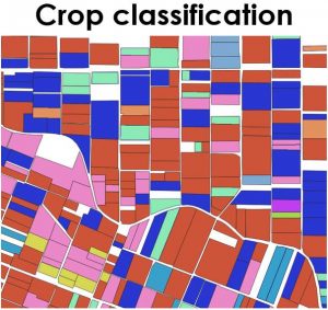
Our automated processing chains of time-series satellite data, such as Copernicus Sentinels and NASA’s Landsat, provide valuable information about crop types and agricultural activity throughout the crop season. We have developed various markers related to crop classification, agricultural activity detection, and parcel homogeneity detection. Further, we assist farmers to monitor their crops remotely, by interpreting crop growth and vegetation health avoiding visits on the field.


Examples of our work


Crop classification map


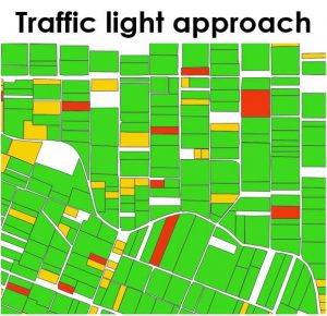
Colored flag map of parcel assessment


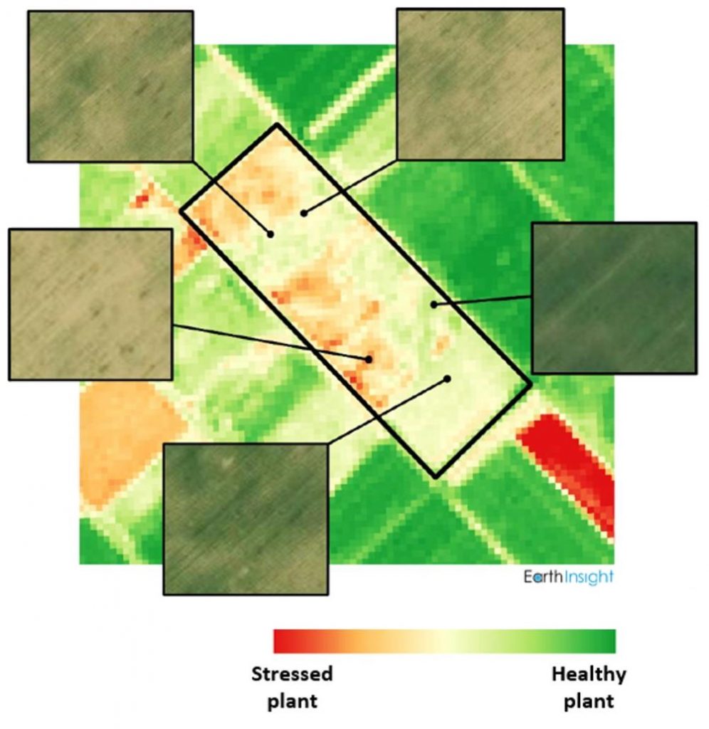
Vegetation index map (NDVI) showing the intra-parcel variability of the crop


Service portfolio:

For public administrators

  • Subsidy controls and monitoring systems
  • GIS solutions for declaration management
  • Inventory systems


For farmers and consultants

  • Smart Farming and crop monitoring systems
  • Supporting declaration submission
Change detection

EO-driven change detection investigates the land cover dynamics and the contemporary land-use pressures on the land environment from multi-modal/multi-temporal data. It  provides essential geographic information to decision-makers for successful planning and management. NEUROPUBLIC integrates its country-wide IoT (Internet of Things) weather station network and EO Data (both public domain and commercial) with state-of-the-art GIS, Data Analytics, and AI (Artificial Intelligence) technologies for change detection applications.

before
After

Change detection interface: images of a crop parcel in central Greece showing land use change for solar energy and greenhouse construction (generated using NP’s AI algorithms from two Sentinel-2 satellite images)

Crop damage assessment

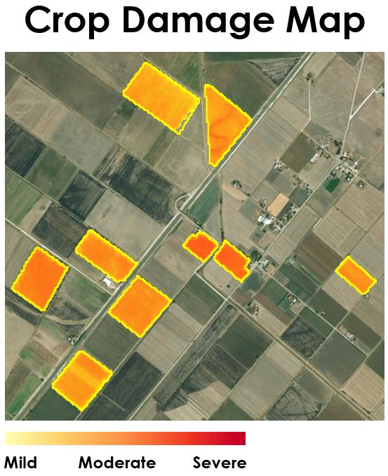
By developing digital remote sensing techniques in combination with IoT technologies, NEUROPUBLIC’s EO team provides cutting-edge services that report automatically and in real-time potential crop damages throughout the entirety of the Greek territory. The user is able to monitor crop performance at any given time and to identify how crops have been affected by severe weather events. As a result, a faster and more reliable agri-insurance management is achieved.

Crop damage map using satellite images